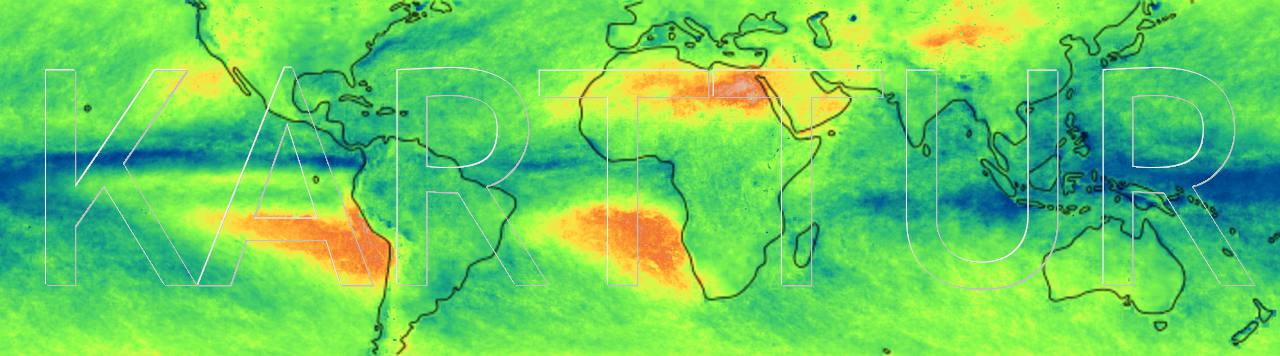
Map: Standard deviation for rainfall 2001-2016, global tropics
Okavango articles and data
Archive of Okavango studies that I have been involved in since my PostDoc period 1991-2001 at University of the Witwatersrand, Johannesburg, South Africa. Each study is associated with spatial data that is available via links in the separate posts.
Landsat satellite image data Landsat satellite image data that was used for creating the Okavango maps during my postdoc period at University of the Witwatersrand in South Africa. Flooding from AVHRR, ATSR and Landsat quicklook images link to original article Flooding Patterns of the Okavango Wetland in Botswana between 1972 and 2000. Geophysiological regions link to original article Portraying the geophysiology of the Okavango Delta, Botswana Ecoregion classification link to original article Ecoregion classification in the Okavango Delta, Botswana from multitemporal remote sensing Regional topography link to original article The topography of the Okavango Delta, Botswana, and its tectonic and sedimentological implications Islands link to original article Channels, wetlands and islands in the Okavango Delta, Botswana, and their relation to hydrological and sedimentological processes