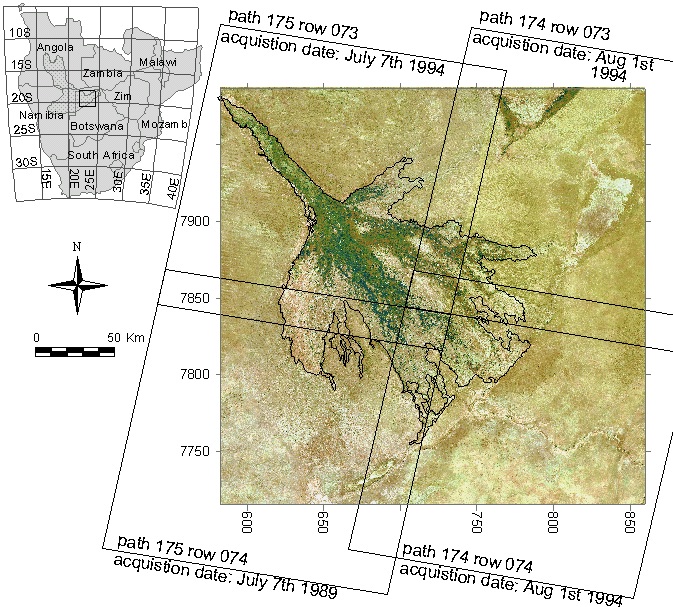
Map: Average rainfall 2001-2016, global tropics OkavangoIslandswetlandschannels Islands The Okavango swamps Figure 1. The Okavango Delta, Botswana; the figure shows the Landsat scenes used the ecoregion classification and the small inset images also shows the Okavango River Basin. Introduction Previous Next