
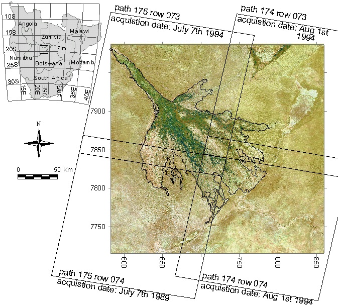
Over a distance of 240 km, from the top of the Panhandle entry channel and down to the Kunyere fault defining the terminal end of the alluvial fan, the drop in elevation over the Okavango swamps, Botswana, is approximately 60 m, Figure 1. Even if the topographic variations in the surface of the Okavango Alluvial Fan is extremely subtle, it still defines the distribution of water and wetlands over the surface of the Alluvial Fan. Over decades to centuries changes in topography, driven both by the sedimentation associated with the active channels and tectonic movements, alter the topography and consequently also the distribution of wetlands.
I spent my Post Doc years (1999-2001) at University of the Witwatersrand (Johannesburg, South Africa) studying the Okavango swamps. My supervisor, prof. T.S. McCarthy got hold of data from a gravity survey over Botswana that also included differential GPS elevations. From that data we constructed a topographic map over the larger Okavango area.
This post summarizes the study on the topography of the Okavango Delta, and also links to the data presented in the published article. If you are only interested in the data, the link to the online repository is given at the end of this post.
Introduction
In the late 1990’s the Geological Survey of Botswana used differential GPS (with cm accuracy) as part of a survey of the gravity of North-Eastern Botswana. The elevation data derived from this survey formed the baseline data for creating a Digital Elevation Model (DEM) and analysing The topography of the Okavango Delta, Botswana, and its tectonic and sedimentological implications. (Gumbricht, T. McCarthy, T.S. & Merry, C.L., 2001) South African Journal of Geology, 104 (3) , 243-264..
Method summary
Different datasets of point measured elevation data were assembled, quality checked and then transformed to the WGS84 datum and finally converted to orthometric heights using EGM96 (Earth Gravity Model 1996). Combining all the datasets, the larger Okavango region was divided along major fault lines, resulting in 4 sub-regions. For the sub-regions, individual DEMs where interpolated using kriging with manually fitted variograms, while also estimating the krigning standard deviation. Using a spatial filter kernel the four parts were smoothed across non-distinct boundaries and then combined. Contour lines were extracted and overlaid the natural color landsat composite. Combining the DEM and the contour lines with other data allowed us to analyze the topography of the palaeo-shorlines of lakes Ngami, Mababe and Mkgadikgadi, the relative elevation of water channels on the alluvial fan as well as other topographic relations.
Elevation datasets
Four different sources of point elevation data were used for interpolating a DEM in 500 m spatial resolution, table 1.
| Dataset | Description |
|---|---|
| gps-grav-survey | Gravity survey with differential GPS positioning Geological Survey of Botswana |
| beacons | Trigonemetric beacons identified from official Botswana maps |
| UCT-GPS | Differential GPS positioning along major channels of the Okavango swamps University of Cape Town |
| DCW | Beacon heights in the Namibian part of Linyanti Digital Chart of the World (DCW) |
Regionalization
The larger Okavango region is clearly defined by fault lines, either trending North-West to South East (the Panhandle tectonic graben); or perpendicular to this direction and trending North-East to South-West (Gumare fault defining the transition from the Panhandle to the Okavango Alluvial Fan and the Kunyere and Thamalakane fault lines defining the terminal end of the alluvial fan). To accommodate the variations in elevation across the fault lines, we divided the larger Okavango area into four sub-regions for the geo-statistical interpolation, tables 2 and 3.
| Region | Rationale |
|---|---|
| NW-drylands | Region North-West of the Kunyere fault line, excluding the Okavango Wetlands. |
| SE-drylands | Region South-East of the Thamalakane fault line, excluding the Boteti River Valley. |
| Kunyere-trappa | The region between the Kunyere and Thamalakane fault lines. |
| Oka-wetlands | The area of maximum flooding in the Okavango wetlands upstream of the Kunyere fault line (includes all channels transgressing the Kunyere-trappa as well as the Boteti River Valley). |
| Layer name | Layer content |
|---|---|
| fault-lines_karttur_okaswamps_0_v2001 | Fault lines |
| rivers-channels_karttur_okaswamps_0_digitized | River channels |
| geophysiology_wits_okaswamps_1994_pub | Geophysiological regions of the Okavango swmaps |
| elev-regions_karttur_okaswamps_0_4demcreate | Elevation regions |
The “NW-drylands” region is intersected by the Panhandle and includes the relict dune-fields west of the Okavango wetlands. The Western side of the Panhandel is uplifted compared to the Eastern side and the relict dunes have heights of approximately 10 meters. These variations where not considered when interpolating the DEM, and consequently the theoretical errors in “NW-drylands” region are comparatively large. The “SW-drylands” is defined as the region South-East of the Thamalakane fault line. It is the most data-poor region and the elevation estimates are poor over some parts of this region. The parallel Kunyere and Thamalakane fault lines define a stair between the Okavango wetlands and the SE-drylands. This stair, or “trappa”, define a third region: “kunyere-trappa”. Finally the Okavango wetlands (the maximum flooding area - see this post) defines the central region: “oka-wetlands”. This region also include all the channels draining the Okavango swamps across the Linyanti-trappa, and also includes the Boteti River valley. All regions have sections where the boundaries are less pronounced. For sections across sub-regions with no, or less, defined fault lines, nearby elevation points from the adjacent region were included in both regions spanning the boundary.
In addition to creating a DEM for the larger Okavango region, we also created three DEMs related to the palaeo-lakes in the Okavango region:
- Ngami
- Mababe
- Mkgadikgadi
All three are situated partly within and partly outside the area of the main map.
North-West drylands
The dryland region to the north west (“NW-drylands”) of the Thamalakane/Kunyere fault line (Figure 2), excluding the Okavango swamps and spanning both sides of the Panhandle entry channel, was interpolated using three combined datasets; GPS elevations from the gravity survey, beacon heights drawn from Botswana maps and heights from the Digital Chart of the World (DCW), table 3.
| Layer name | Layer content |
|---|---|
| elev-pt-subreg_gps-grav-survey_okaswamps_2000_nw-drylands | GPS surveyed elevations |
| elev-pt-subreg_beacons_okaswamps_2000_nw-drylands | Trigonometric beacon heights |
| elev-pt-subreg_dcw_okaswamps_2000_nw-drylands | Digital Chart of World heights |
South-East drylands
The south eastern region (“SE-drylands”), on the uplifted side of the Thamalakane fault and intersected by the Boteti valley, was interpolated using GPS elevations from the gravity survey and beacons identified from Botswana maps, table 4.
| Layer name | Layer content |
|---|---|
| elev-pt-subreg_gps-grav-survey_okaswamps_2000_se-drylands | GPS surveyed elevation |
| elev-pt-subreg_beacons_okaswamps_2000_se-drylands | Trigonometric beacon heights |
Kunyere trappa region
The region between the Kunyere and Thamalakane fault lines (“kunyere-trappa”) (figure 2) was interpolated separately. The region is intersected by the rivers draining the distal arms of the Okavango swamps before they join the Thamalakane River (defined by the Thamalakane fault line). The “Kunyere-trappa” region was interpolated using GPS elevations from the GPS/gravity survey and trigonometric beacon heights from Botswana maps, table 5.
| Layer name | Layer content |
|---|---|
| elev-pt-subreg_gps-grav-survey_okaswamps_2000_kunyere-trappa | GPS surveyed elevation |
| elev-pt-subreg_beacons_okaswamps_2000_kunyere-trappa | Trigonometric beacon heights |
Okavango wetlands region
The last, central, region is the area of maximum flooding (see this post) of the Okavango wetlands, “oka-wetlands”. To interpolate this region we used three different data sets; GPS elevations from the gravity survey, beacon heights from Botswana maps and GPS points collected by University of Cape Town (UCT), table 6.
| Layer name | Layer content |
|---|---|
| elev-pt-subreg_gps-grav-survey_okaswamps_2000_oka-wetlands | GPS surveyed elevation |
| elev-pt-subreg_beacons_okaswamps_2000_oka-wetlands | Trigonometric beacon heights |
| elev-pt-subreg_gps-uct_okaswamps_2000_oka-wetlands | GPS survey by University of Cape Town |
Unused trigonometric heights
Not all trigonometric beacon heights identified in various Botswana maps were used. For completeness, also the unused elevation points are supplied here, table 7.
| Layer name | Layer content |
|---|---|
| elev-pt-unused_beacons_okaswamps_2000_all-regions | Unused beacon heights |
Okavango DEM
The DEM for the larger Okavango region was created by combining the four regional DEMs and then smoothing the compositional DEM across areas with no pronounced faults (see the original article for details). A few pronounced heights and troughs were added, and the elevation contour lines extracted. The final DEM, as a 500 m raster and as contour lines are listed and available for download in table 8.
| Layer name | Layer content |
|---|---|
| Vector layer (shape file) | |
| elev-contours_karttur_okaswamps_0_v2001 | Elevation contour lines for the larger Okavango area. |
| Raster layers (GeoTiff files) | |
| dem_karttur_okaswamps_0_v2001 | Geo-interpoalted DEM in 500 m spatial resolution |
| dem-sd_karttur_okaswamps_0_v2001 | Estimated error (1 standard deviation) of the interpolated DEM |
| dem_karttur_ne-bw_2000_v2001 | Geo-interpoalted DEM over NV Botswana |
The Okavango Alluvial Fan
The Okavango Alluvial Fan (Figure 3), forms an almost perfectly shaped cone where small variations potentially could reveal sedimentation, erosion or tectonic movements. To compare the interpolated DEM with a theoretical cone, several spatial entities related to the Okavango Alluvial Fan were identified or created, table 9.
| Layer name | Layer content |
|---|---|
| Vector layers (shape files) | |
| alluvial-fan-apex_karttur_okaswamps_0_v2001 | The apex (beginning, point from spreading out) of the Okavango Alluvial Fan |
| alluvial-fan_karttur_okaswamps_0_v2001 | The surface area of the Okavango Alluvial Fan |
| alluvial-fan-isodist_karttur_okaswamps_0_fromapex | Iso-distance lines (25 km interval) from the apex |
| Raster layers (GeoTiff files) | |
| alluvial-fan-cone-dem_karttur_okasvamps_0_v2001 | Idealized, perfectly cone shaped DEM over the Okavango Alluvial Fan |
| alluvial-fan-residual-dem_karttur_okasvamps_0_v2001 | Elevation difference between the idealized and the interpolated DEMs over the Okavango Alluvial Fan |
Lake Ngami Region
As noted above, a special DEM was created for Lake Ngami and its surroundings. The palaeo shorelines of Lake Ngami were omitted from the DEM, that thus shows the base level of these shorelines. Extracting the base levels we could analyse the topography of the shorelines. The results indicate that the palaeo shorelines are tilted towards north-east. All the data for the Lake Ngami DEM analysis are listed in table 10.
| Layer name | Layer content |
|:——————————————————————————————————————————|:——————————————————————————————————————————————————|
| Vector layers (shape files) | |
| [centreline_karttur_lakengami_0v2001](../../docs/dem/lakengami/centreline_karttur_lakengami_0_v2001.zip) | The central axis of Lake Ngami
(for analysing tilting) |
| elev-contours_karttur_lakengami_0_v2001 | Elevation contour lines for the Lake Ngami basin,
_disregarding any ridges (i.e. palaeo-shorelines)
or channels. |
| elev-pt-palaeo-shore_karttur_lakengami_0_v2001 | Elevation point data (best estimate and error)
extracted from the generated DEM (GeoTiff)
for the base level of Lake Ngami palaeo-shorelines. |
| elev-pt_beacons_lakengami_0_frommap | Input elevation data from existing beacons,
used for the geo-interolation |
| elev-pt_gps_lakengami_1999_grav-survey | Input elevation data from a precision
gravity/GPS survey, used for the geo-interolation |
| isodist_karttur_lakengami_0_centreline | Distances along the central axis (see top row)
for defining proximity (tilting) along palaeo-shoreliens |
| palaeo-shore-line_karttur_lakengami_0_v2001 | Lake Ngami palaeo shorlines
interpreted from Landsat image |
| Raster layers (GeoTiff files) | |
| dem_karttur_lakengami_0_v2001 | Geo-interpoalted DEM in 500 m spatial resolution |
| dem-sd_karttur_lakengami_0_v2001 | Estimated error (1 standard deviation) of the interpolated DEM |
| natcol_lt05_lakengami_199407_byte | Natural color Landsat TM image |
Mababe Depression Region
The special DEM for the Mababe depression was done using only the gravity GPS surveyed elevations points. The DEM for the Mababe depression excludes all local ridges, including the palaeo shoreline defining palaeo Lake Mababe. Water channels, including the drainage connecting Mababe Depression with both the Linyanti and Okavango swamps are also excluded.
The results indicate that the palaeo shorelines are tilted towards south-west, which is exactly opposite the tilting of the shorelines of Lake Ngami. This suggests that the region between the two palaeo-lakes must have sunken since the lakes died out. In the scientific article we speculate that this depends on sagging due to the shear weight of the sediments deposited over the Okavango Alluvial Fan. All the data for the Mababe depression DEM are listed in table 11.
| Layer name | Layer content |
|---|---|
| Vector layers (shape files) | |
| centreline_karttur_mababedepr_0_v2001 | The central axis of Mababe Depression (for analysing tilting) |
| elev-contours_karttur_mababedepr_0_v2001 | Elevation contour lines for the Mababe Depression, disregarding any ridges (i.e. palaeo-shorelines) or channels. |
| elev-pt-palaeo-shore_karttur_mababedepr_0_v2001 | Elevation point data (best estimate and error) extracted from the generated DEM (GeoTiff) for the base level of Mababe Depression palaeo-shorelines. |
| elev-pt_gps_mababedepr_1999_grav-survey | Input elevation data from a precision gravity/GPS survey, used for the geo-interolation |
| isodist_karttur_mababedepr_0_centreline | Distances along the central axis (see top row) for defining proximity (tilting) along palaeo-shoreliens |
| palaeo-shore-line_karttur_mababedepr_0_v2001 | Mababe Depression palaeo shorlines interpreted from Landsat image |
| Raster layers (GeoTiff files) | |
| dem_karttur_mababedepr_0_v2001 | Geo-interpoalted DEM in 500 m spatial resolution |
| dem-sd_karttur_mababedepr_0_v2001 | Estimated error (1 standard deviation) of the interpolated DEM |
| natcol_lt05_mababedepr_199407_byte | Natural color Landsat TM image |
Mkgadikgadi Ridge Region
The special DEM for the Mkgadikgadi Ridge was done using only the gravity GPS surveyed elevations points. The DEM for the Mkgadikgadi Ridge region excludes all local ridges, including the Mkgadikgadi Ridge (Lake Mkgadikgadi palaeo shoreline) itself. Also water channels, including the drainage along the Boteti River are excluded.
The results indicate that the palaeo shoreline is not level with the geoid but has a dip that is at its deepest exactly along the central axis of the Okavango Alluvial Fan. This corroborates the hypothesis that sagging has caused the tectonic depressions along the central axis of the Okavango Alluvial Fan, including the Panhandle entry channel.
When restoring the data in July 2019 (almost 20 years after the work was done), the layer for the estimated DEM confidence level (dem-sd_karttur_mkgadiridge_0_pub.tif) had one row and one column less compared to the interpolated DEM itself (dem_karttur_mkgadiridge_0_pub.tif). I could not find the reason, and the layers available thus differ in size. All the data for the Mkgadikgadi Ridge Region DEM are listed in table 12.
| Layer name | Layer content |
|---|---|
| Vector layers (shape files) |
| elev-contours_karttur_mkgadiridge_0_v2001 | Elevation contour lines for the Makgadikgadi Ridge region, disregarding any ridges (i.e. palaeo-shorelines) or channels. |
| elev-pt-palaeo-shore_karttur_mkgadiridge_0_v2001 | Elevation point data (best estimate and error) extracted from the generated DEM (GeoTiff) for the base level of Makgadikgadi Ridge (palaeo-shoreline). |
| elev-pt_gps_mkgadiridge_1999_grav-survey | Input elevation data from a precision gravity/GPS survey, used for the geo-interolation |
| isodist_karttur_mkgadiridge_0_paleoshoreline | Distances along the palaeo shore line for defining proximity (tilting) |
| palaeo-shore-line_karttur_mkgadiridge_0_v2001 | Makgadikgadi palaeo shorlines interpreted from Landsat image |
| Raster layers (GeoTiff files) | |
| dem_karttur_mkgadiridge_0_v2001 | Geo-interpoalted DEM in 500 m spatial resolution |
| dem-sd_karttur_mkgadiridge_0_v2001 | Estimated error (1 standard deviation) of the interpolated DEM |
| natcol_lt05_mkgadiridge_199407_byte | Natural color Landsat TM image |
Okavango swamps water level DEM
The survey campaigns conducted by University of Cape Town (UCT) during 1994, 1995, 1996 and 1998 also included measurements of the elevation of surface water, table 13. The 1995 campaign was the most extensive. Using sites with overlapping elevations, all the UCT surface water level data were linearly transferred to represent the 1995 situation. The adjusted elevation data was then used for constructing a surface water table DEM for the Okavango wetlands, table 13.
| Layer name | Layer content |
|---|---|
| Vector layers (shape files) | |
| elev-pt-water_gps-uct_okaswamps_1994_v2001 | Water surface elevation from the UCT 1994 campaign. |
| elev-pt-water_gps-uct_okaswamps_1995_v2001 | Water surface elevation from the UCT 1995 campaign. |
| elev-pt-water_gps-uct_okaswamps_1996_v2001 | Water surface elevation from the UCT 1996 campaign. |
| elev-pt-water_gps-uct_okaswamps_1998_v2001 | Water surface elevation from the UCT 1998 campaign. |
| Raster layers (GeoTiff files) | |
| dem-water-surface_karttur_okaswamp_1995_v2001 | DEM for the Okavango water table |
Resources
GitHub repo with fault lines, river channels and elevation regionalizations.
GitHub repo with Elevation point data used as input for generating DEM.
GitHub repo with Elevation data covering the greater Okavango region.
GitHub repo with Elevation data covering palaeo Lake Ngami.
GitHub repo with Elevation data covering palaeo Lake Mababe.
GitHub repo with Elevation data covering Mkgadikgadi Ridge.
GitHub repo with water surface elevation data covering the Okavango wetlands.
GitHub repo with data related to the Okavango Alluvial Fan.
Acknowledgement
The work was done as part on an international co-operation within the Okavango Research Group headed by prof. T.S.McCarthy, Department of Geology, Wits University. My post doctoral scholarship was financed by the Swedish Royal Academy of Sciences.