
Introduction
Archived Landsat satellite imagery can be accessed in a variety of different ways. This post specifically deals with manual ordering of special products. The accessing as such is not part of Karttur’s GeoImagine Framework. The post, however, covers how to import ordered data into the Framework.
Landsat Collection 1 Surface Reflectance
Landsat Collection 1 Surface Reflectance.
Data access (November 2020):
Register with USGS EROS
Before you can use the services of the United States Geological Services (USGS) Earth Resources Observation and Science (EROS), you need to register and create an account at the USGS EROS registration system.
Eartexplorer
For a few scenes and dates USGS Earthexplorer is an excellent alternative for ordering land surface reflectance corrected scenes.
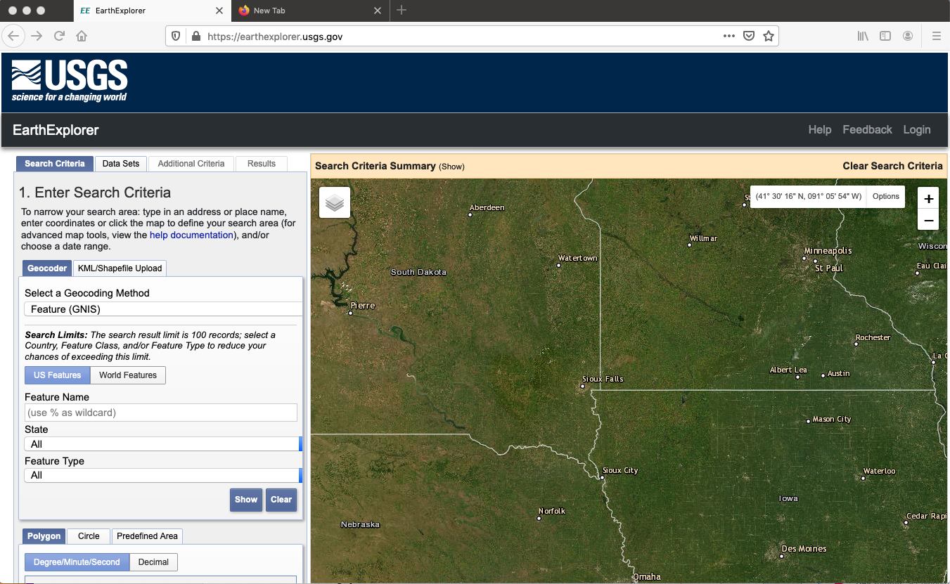
In the Earthexplorer front page you have a panel for Search Criteria to the left and a map to the right. To order scenes you need to enter information on:
- search area,
- date and seasons,
- product.
Additionally you can also set search criteria for quality and for example cloudiness.
Search area
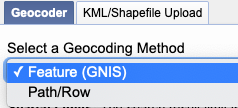
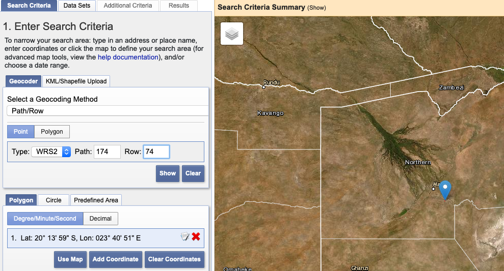
The first step is to define a search area. You have several options; to search for a location name (the default), to define a path and row in the Landsat WRS system (click in the text box for Select a Geocoding Methods and choose the option Path/Row). You can also choose to upload a georeferenced vector file under the tab KML/Shapefile Upload.
In the example below I have entered Path and Row for the Okavango Delta in Botswana.
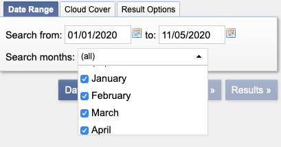
Select date range
Towards the bottom of the Search Criteria you select the date range. If you select a multi-year range you can restrict the search to particular months.
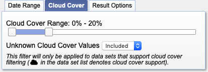
Select maximum cloud cover
You can also set the search criteria for maximum cloud cover by clicking the tab next to the . Cloud cover can also be sett from the tab (see below).
Select Data Sets
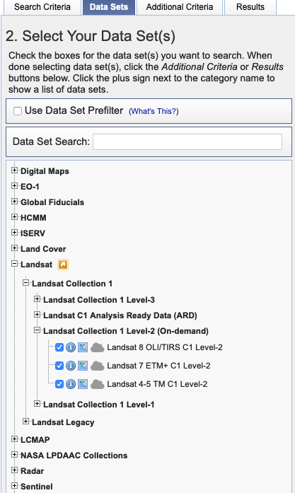
 With the search area and date range set, the next step is to Select which Data Sets to search for. Either click the button at the buttom of the Search panel, or the tab at the top. The atmospherically corrected Landsat data are found under
.
With the search area and date range set, the next step is to Select which Data Sets to search for. Either click the button at the buttom of the Search panel, or the tab at the top. The atmospherically corrected Landsat data are found under
.
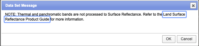
When you click the check-box a message pops up informing you that the panchromatic and thermal bands are not going to be corrected. Just click
Additional Criteria
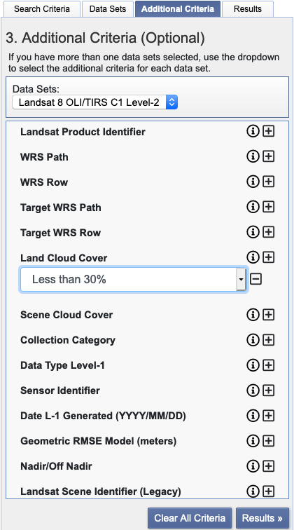
 Again either click the button or tab. The criteria differs between different data sets. For Landsat data sets it is mainly the cloud cover that is of interest.
Results
 With all the search criteria set, click the button or tab. Results are organised per Data Set, and then in a list with small quicklooks and buttons for checking and ordering each Data Set (image or scene).
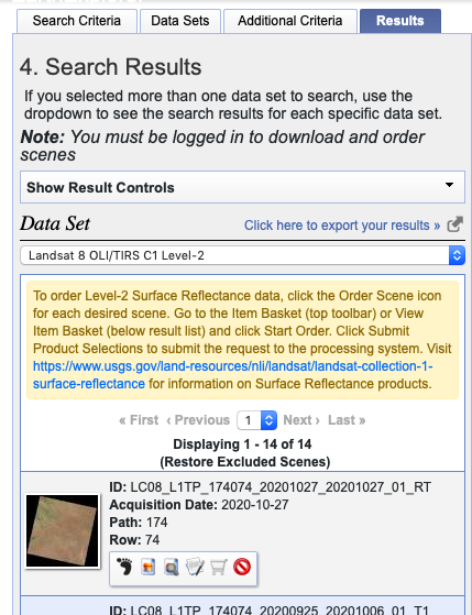
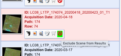 Data sets that does not meet the standard you are looking for can be excluded from the results.
Order scene
To order a scene you must be logged in to USGS EROS. If you are not logged in, the shopping cart in the row of buttons for each Data Set is dimmed (like above). And you can not order the scene or image. 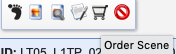 If you are logged in, the shopping cart symbol will be fully black, and you can click it.
Shopping basket
 When you have ordered the scenes you want to retrieve, click the button below the left panel with quiklooks.
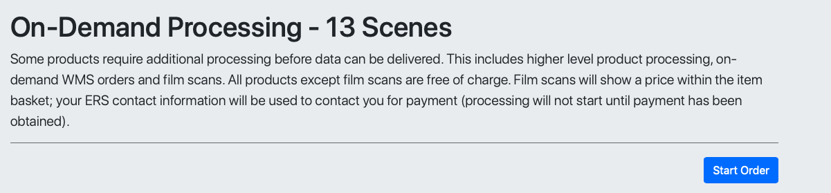
On demand processing
When doing this in November 2020 I then got a very large type faced message about the On-demand processing. Just click .
In the next step you can remove items from your shopping basket and set a few options. I removed all but two of the initially ordered scenes, so my list shrank from 13 to 2 items. to queue up your order in the online processing chain.

the processing from Top Of the Atmosphere (TOA) reflection to Land Surface Reflection (LSR) takes a while. Your processing order will get an id, and you have to wait for it to be done, you can check the status out through the url you to the Order Tracking page, also sent to the email address you gave when you registered.